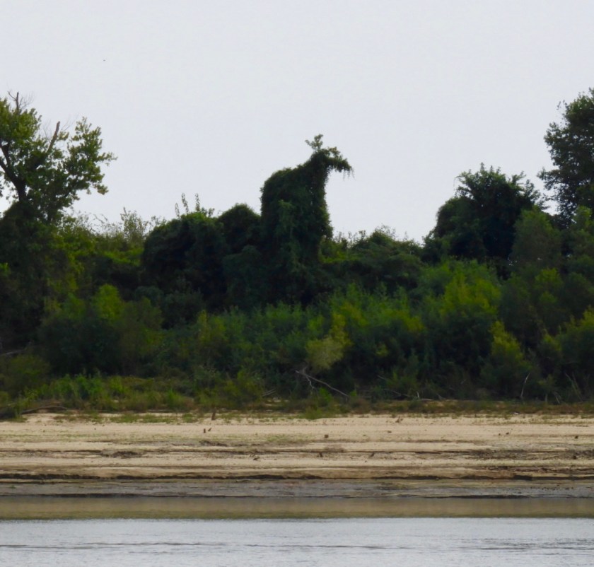
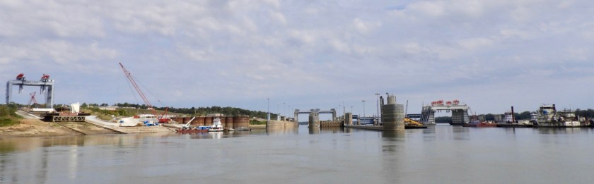
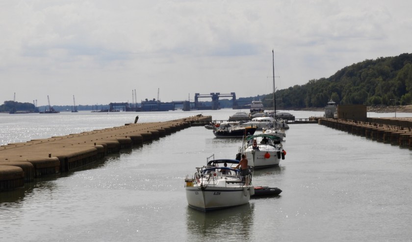
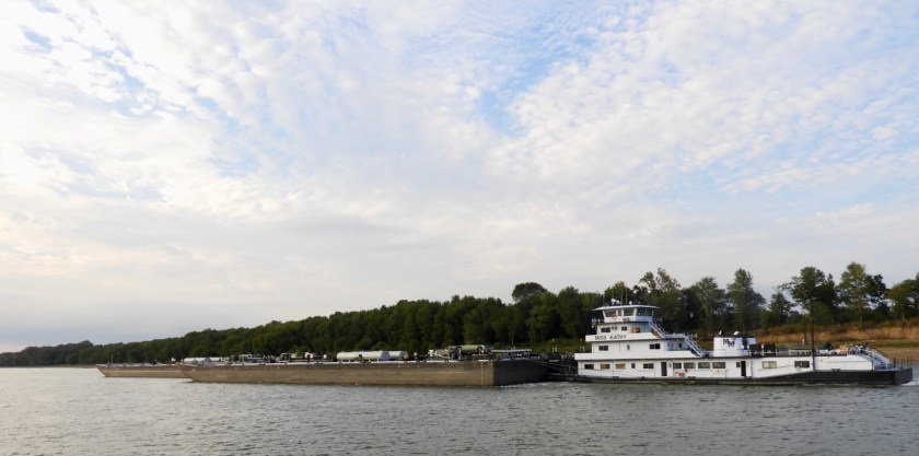
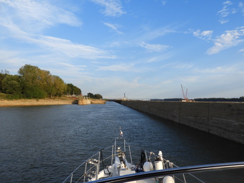
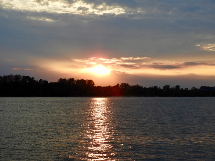
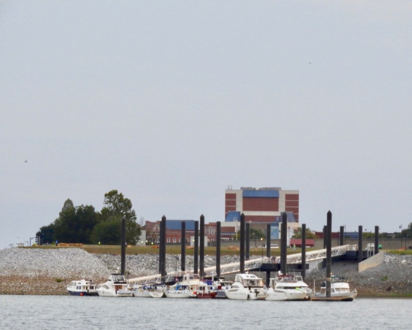
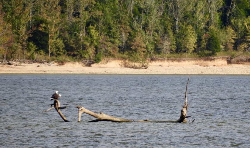
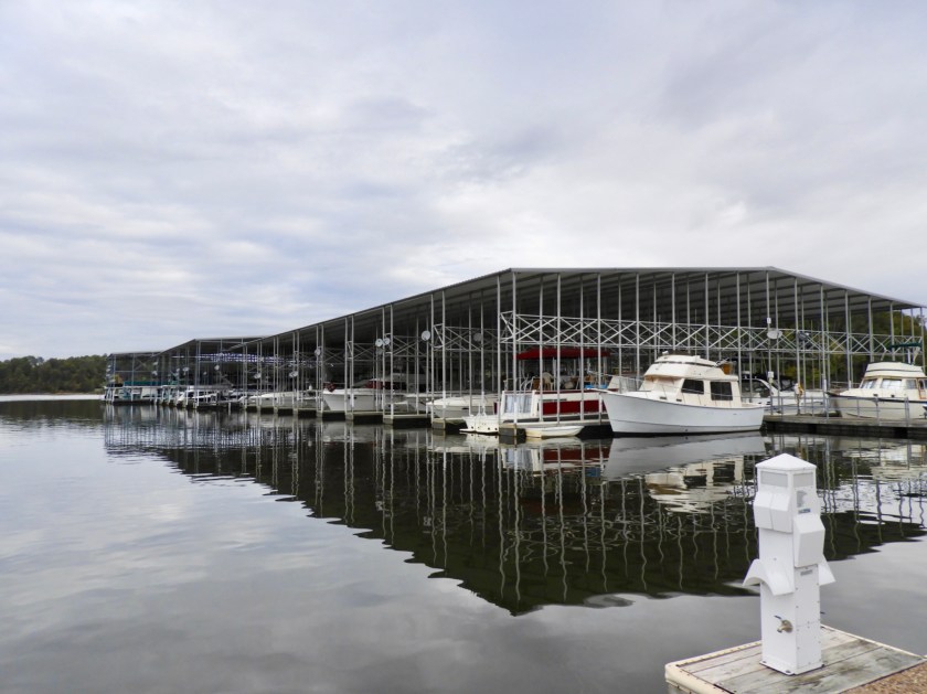
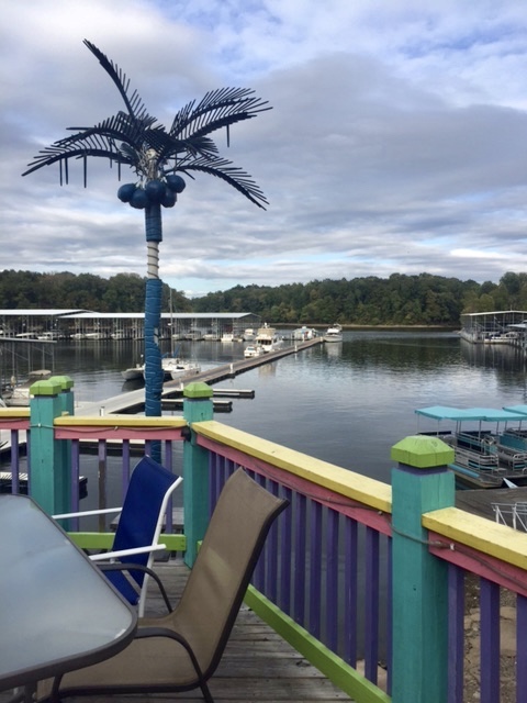
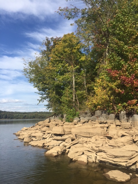
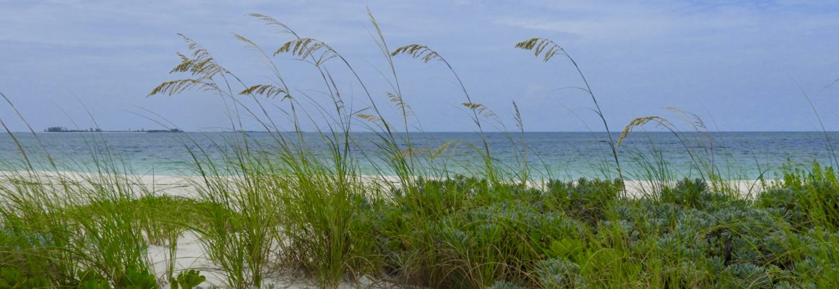
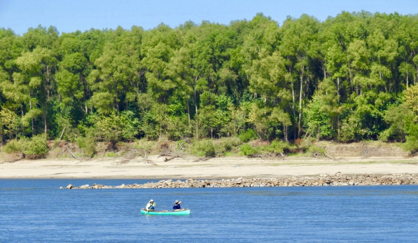
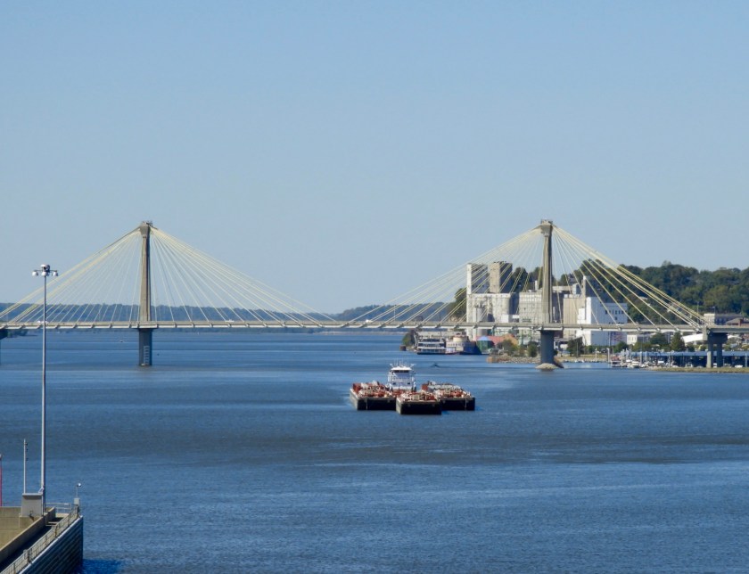
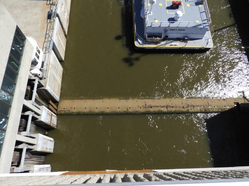
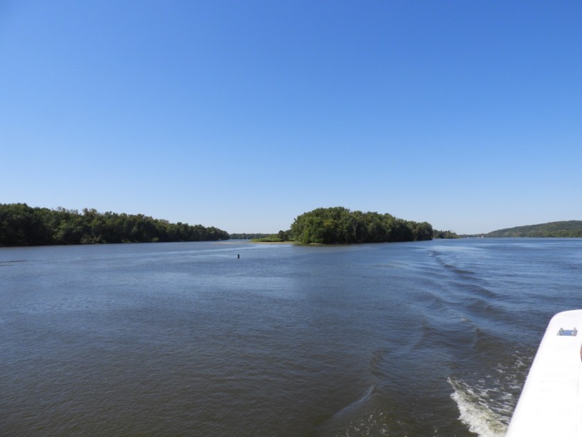
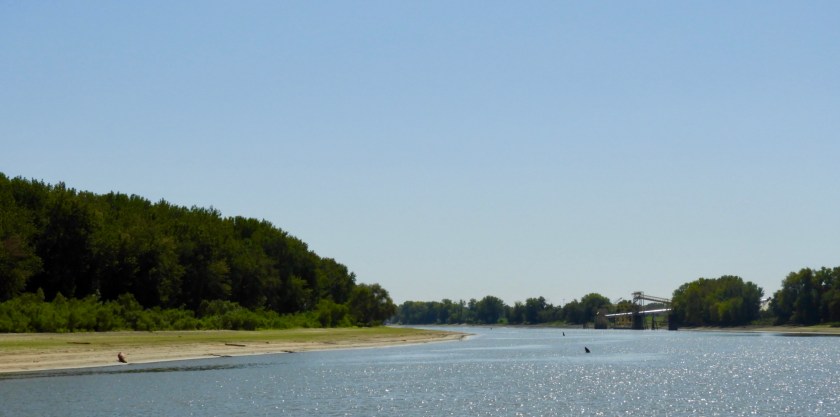
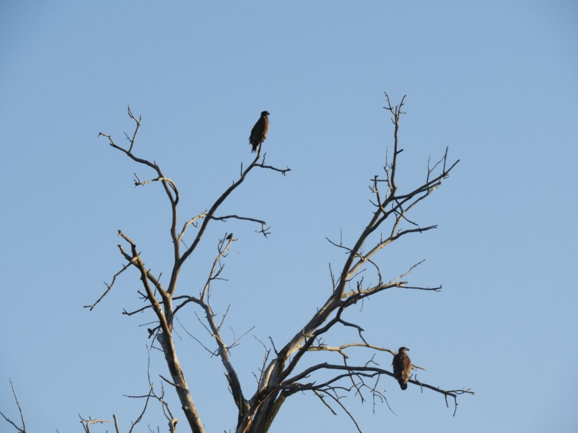
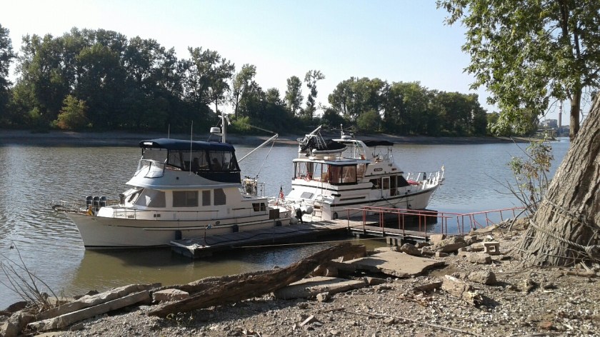
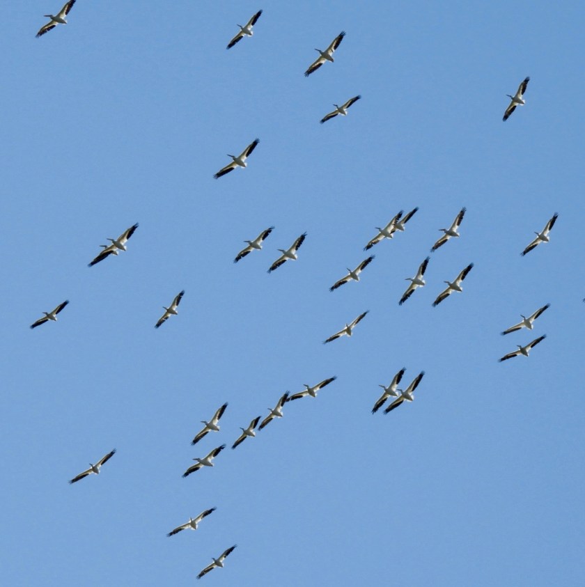
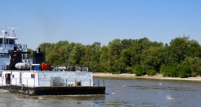
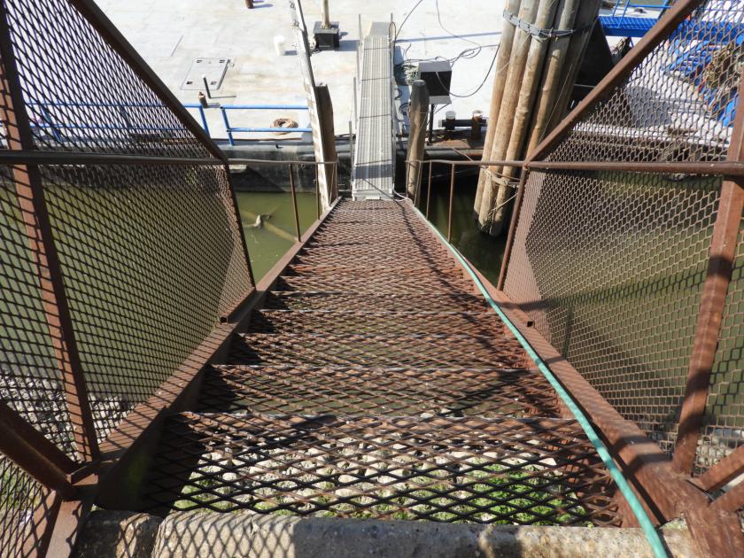
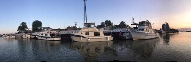
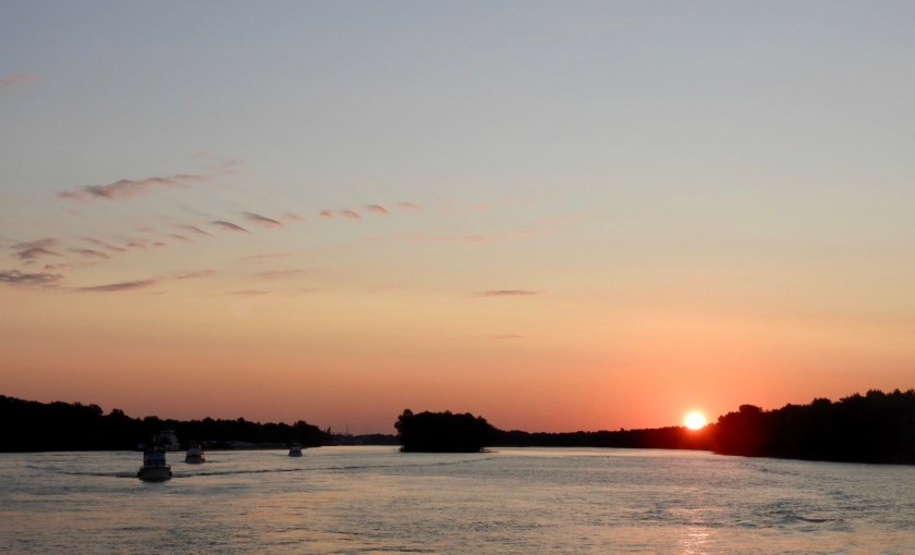
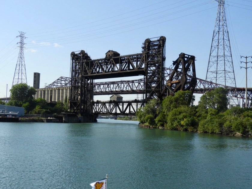
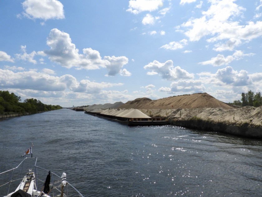
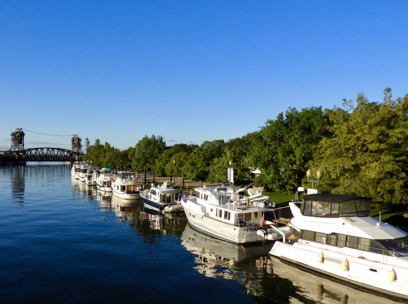
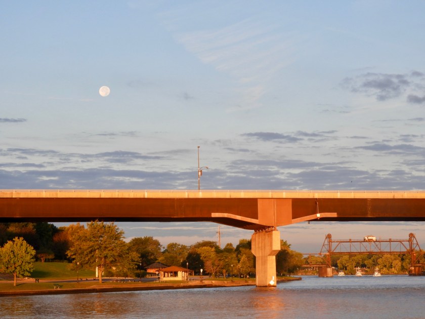
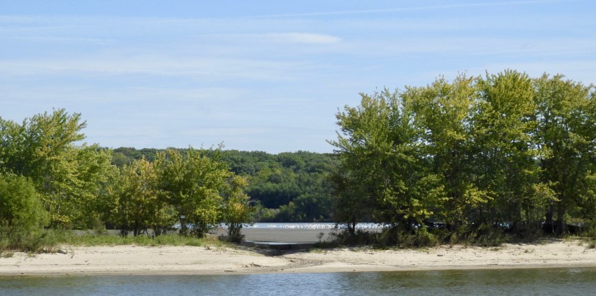
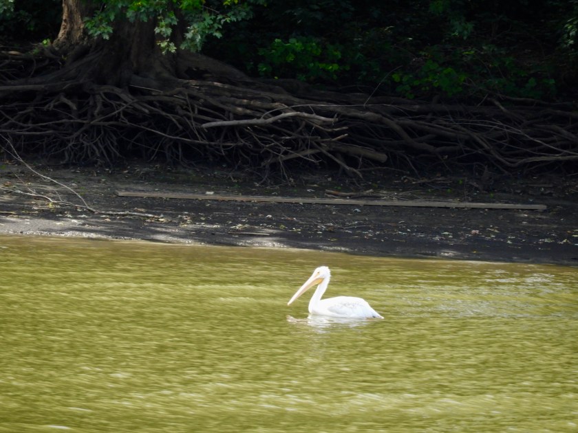
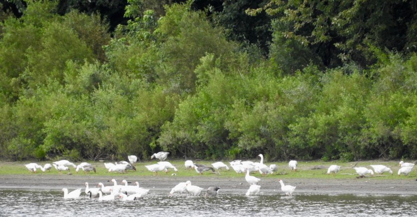
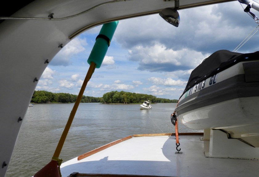
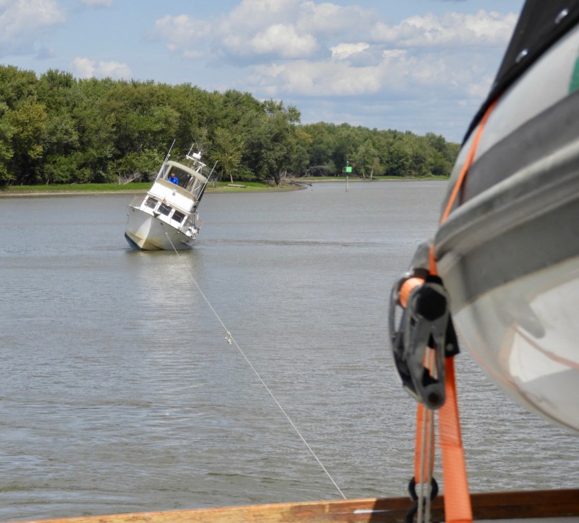
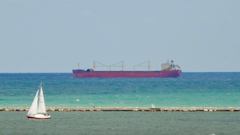
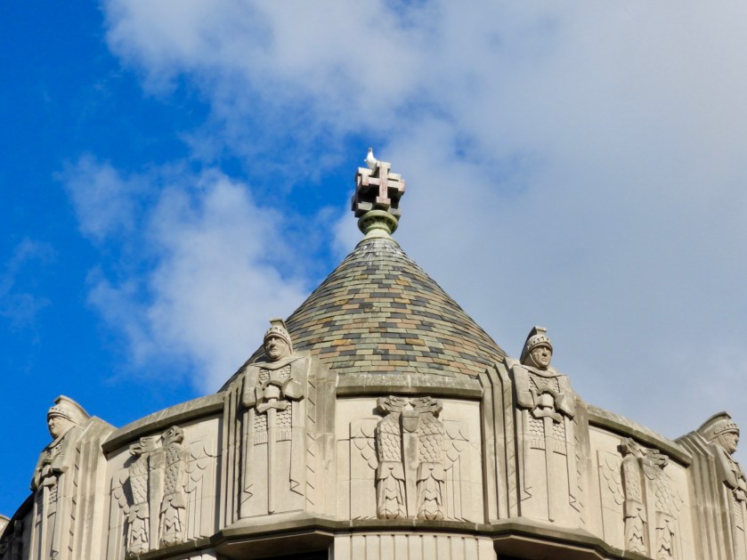
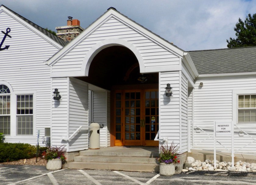
October 1: Apropos to see a magnificent Paddlewheeler on the Mississippi. From last night’s crazy current anchorage we swiftly covered 30 miles on the Mississippi where we then turned north on the Ohio. At this junction, the Mississippi is essentially a commercial canal for 954 miles with little to no services for pleasure boats. Thus, Loopers take an alternative route through several rivers. We needed to brush up on our inner USA geography! This picture was taken at the confluence of the Ohio and the Mississippi. (But we’re looking at the state of Illinois in the middle!)Basically the final portion of the Upper Mississippi was a “W.” When we turned north on the Ohio, not only were we hit with a strong current against us, but a quagmire of tows and barges. Each green triangle represents a tow, and for every tow there were 1 to 20+barges. The Cairo, Illinois Bridge. I liked the line up of the empty box cars going over the bridge. A Dr. Seuss critter topiary. Heading into the Olmstead Lock and Dam, currently a pass through until construction is complete (2020). This lock will replace the next two locks which are quite decrepit and slow. Boys and their toys.The walls, if you will, of Lock 53. We were instructed to just float and not tie up. Yay, not sure what we would have tied up on. Lock master had a Shriner’s clown car for getting from one end of the lock to the other. We really lucked out. This group of sailboats waited for hours before being let in. Turn around time is about 3 hours (to let in a tow, fill the lock, let that tow out, let another tow in going the opposite way and then emptying the lock). Lock masters are obligated to let pleasure boats pass through every three turn arounds. We’ve had some friends have to wait 7+ hours and/or overnight. But as we approached this lock the lock master actually called us and told us to hurry up so he could lock us through with the sailboaters. It took an hour and five minutes to raise the water 14 feet. Not complaining, at least we got through! Note the tow with barges immediately behind the gate. Seeing lots of bird life along the way. Lucked out again, waited about 20 minutes at Lock 52. The Lock Master called us and said to come on in, he didn’t have a tow waiting! This is the second time we’ve seen the Miss Kathy several days ago in the Mississippi. Busy lady!But he did have one waiting on the other side so he lifted us up fairly quickly to accommodate the next tow. Had the lock to ourselves!Got out just ahead of sunset, only 5 miles to go to the Paducah Town Dock for the night. Good thing, we prefer not to travel the rivers at night. Even though we made reservations, there was no room for us! A panic moment, now where? And night approaching fast!Fortunately, Loopers being Loopers they came to our rescue, they bunched up a bit and made room for us at the gas dock, with a few inches to spare. (I took this shot in the morning after 2 boats had already left). Steep stairwell – they are well prepared for the rising and falling of the Ohio River. Oct. 2: Just north of Paducah, Kentucky, is the mouth of the Tennessee River. We headed north for 12 more miles and then turned into the Cumberland River. Very few homes along this section of the Cumberland.A bit of industry.But mainly miles of scenic shoreline.Heading in to the gigantic Barkley Lock. There was one other boat – a small fishing boat to the right that is barely visible. This modern lock lifted us up 57 feet in 15 minutes!Lots of debris, deadheads and bird life to look out for as we enter Barkley Lake.We couldn’t get into the favorite Looper marina (Green Turtle Bay) but this marina, the Buzzards Rock Marina and “Resort” had plenty of room. This trimaran, per owner Jason, sailed around the world and survived a hurricane. Now Jason has purchased it, is fixing it up and also wants to sail her around the world. Good luck with that! The local boaters prefer the covered slips, and judging by all the satellite dishes, looks like they like TV too. The multicolored posts reminded me of the decor at Nippers Bar in Guana Cay, Bahamas. Sign on the side door said Open, but sadly they were not. Dinner on the boat it is. We were the only transient boat in the marina!This scene reminded me of a page out of Highlights Magazine – How many buzzards can you find?Even the dead end sign had vultures on it!October 3: We digressed from the usual loop and headed east on the Cumberland so as to travel to Nashville about 170 miles away. We went by the Kentucky State Prison, known locally as the Castle on the Cumberland. Getting to the root of the problem…Shades of Florida, pelicans on a sand bar.The only tow we had to deal with today. So to recap, the usual Loop goes from the Upper Mississippi to the Ohio, to the Tennessee River, through Kentucky Lake to the left. We went to the Cumberland and into Barkley Lake and will continue on the Cumberland to Nashville. We will have to retrace our steps to Kentucky Lake to then head further south on the Loop. Barkley Lake has lots of nooks and crannies for anchoring – although some are pretty shallow now. This was the case for this anchorage called Dry Creek. I actually got on the paddle board to sound out this channel. There was one spot that was 6.5 feet, otherwise we had 10+ feet in the channel. Took a nice paddle around the small lake. Noticed these rocks under the trees that had interesting swirls of erosion marks. Our front and back yards for the evening. The sunset was not too spectacular, but the moon rise was great!
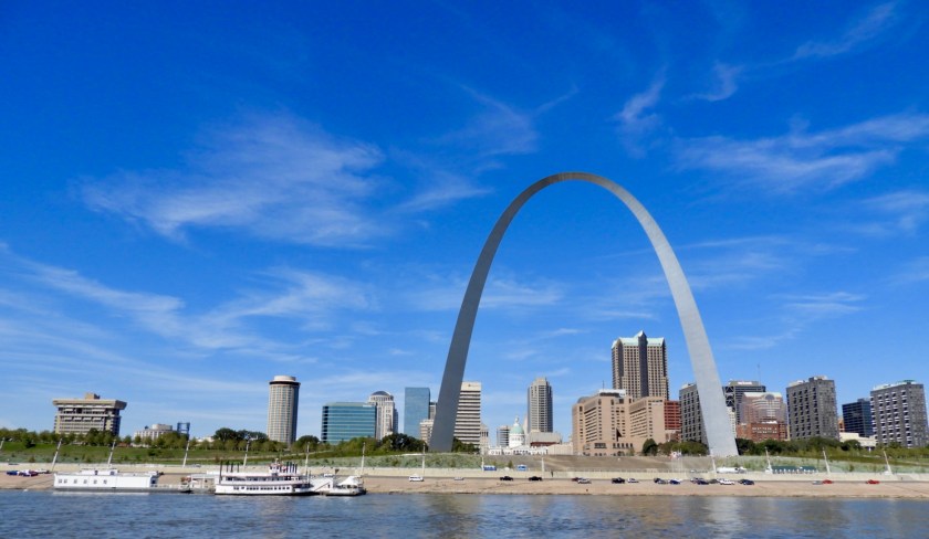
9/29:We left Alton Marina at 7am with 7 other loopers. Here we are in the Mel Price Lock looking back at the Clark Bridge with the Alton marina to the right. You can also see the bridge above the lock, this is where I took pictures from yesterday when we toured the lock. 15 miles south we waited for about a half hour for this tow to exit the lock. Not sure why tows are called tows since they actually push the barges. Approaching St. Louis, Gateway Arch is in the background. Great view of the Arch, sorry it didn’t work out for us to actually go up the arch. No public marinas in St. Louis. Apparently the Mississippi’s current and fluctuating water levels are just too much to keep up with. Leaving St. Louis, a quagmire of pleasure boats to the left, huge “tows” in the middle to dodge and staged barges anchored to the right. Still life of rust of I don’t know what.Went down river about 60 miles to Hoppie’s Marina. This is a “must-do” stop in Looper World. It is owned by the Hopkins family, Charles Hopkins is known as Hoppie and his wife Fern advises Loopers on the current river hazards every day around 5pm. The marina is made up of rusted barges. They do provide power, but no water and no other amenities. A short 10 minute walk brought me into Kimmswick, Mo. This tiny town is filled with cute shops that sell lots of tchotchkes. They have an apple butter festival at the end of October that attracts 300,000 people. Can’t wrap my head around that, but apparently it’s a big deal here.
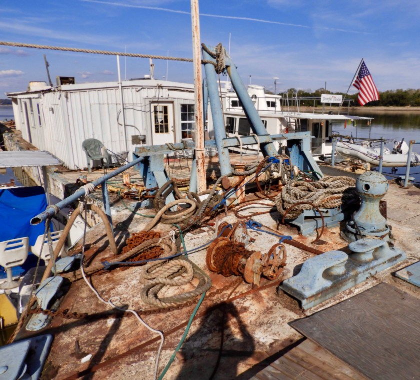
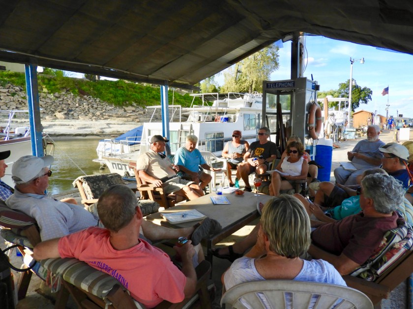
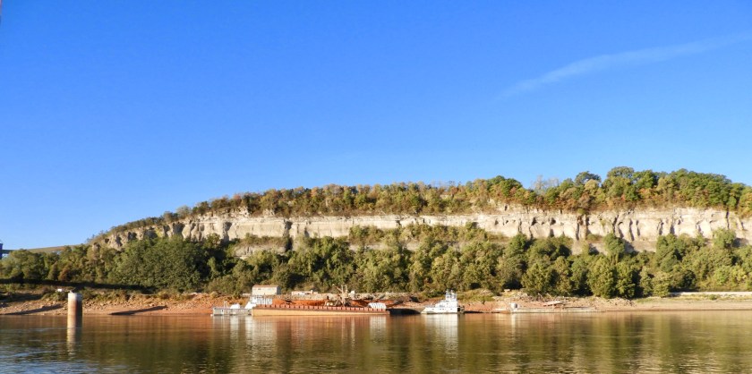
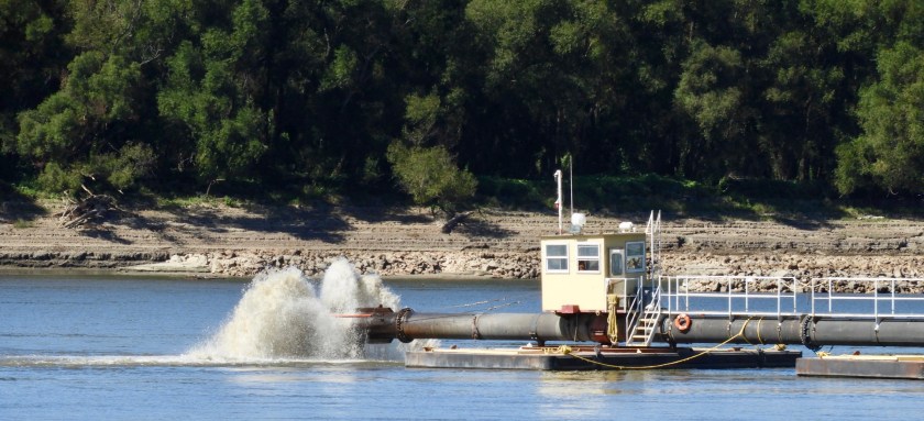
Buildings and shops in Kimmswick, the first two were built in 1840, same year as our daughter Jessi’s house (and our in-law apartment). Back at the marina. The cable at the top of the picture holds one of the barges in place. This marina survived the epic 1993 flood which raised the Mississippi to above the level of the cables. A study in rust and rope. The famous Fern comes down in her golf cart to brief the Loopers. At age 80+, she reminded me of my mother in law Joan. Fern holding court. Note the gentleman in the wheel chair. He and his wife own a boat that is “one level.” He runs the boat while his wife handles all the lines. Pretty cool. Fern finishing up her seminar with several Loopers taking notes. September 30, We left at sunrise. Morning sun lights up this magnificent house. We have seen very few houses along the Mississippi, again, the ever changing water levels must be a deterrent for building nearing the River’s edge. The cliffs of the Mississippi along with random staging areas for filling barges with stone and/or gravel. A few pelicans on the shore. We did see several eagles today and lots of monarchs gliding by.A dredging operation. Aft end of the dredging operation. Bucolic scene of the Mississippi – miles and miles of tree lined shore, minimal houses, sandy shore and no litter. This may be as close as we get to seeing Huck and Tom along the Mississippi.
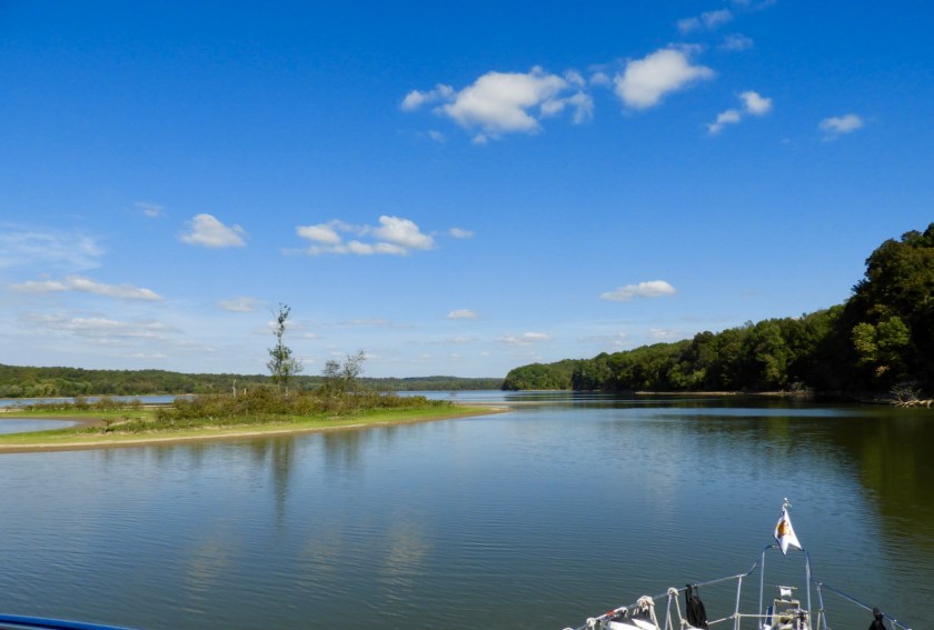
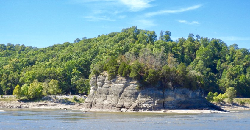
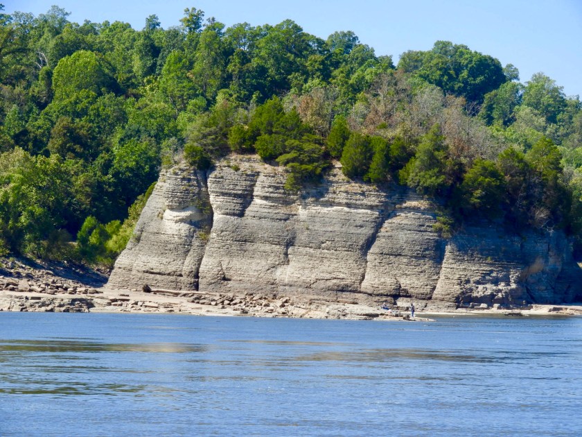
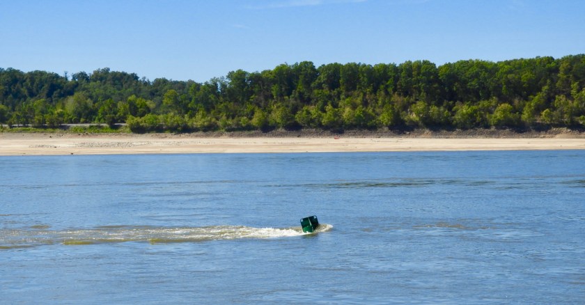
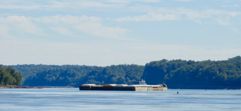
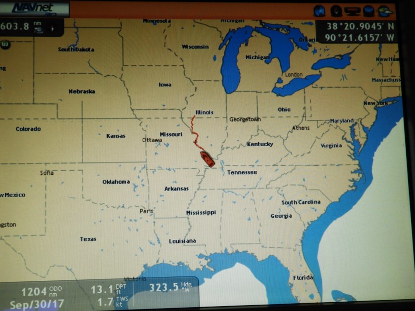
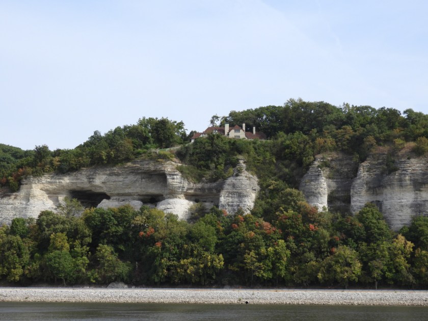
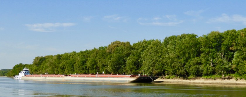
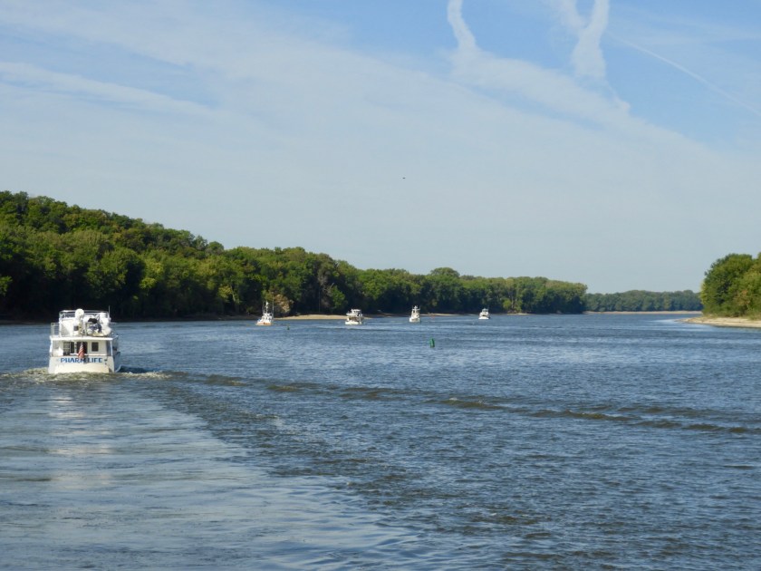
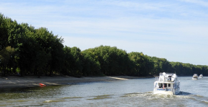
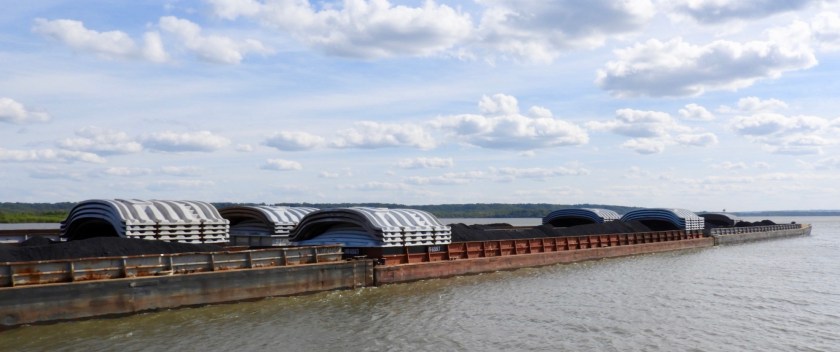
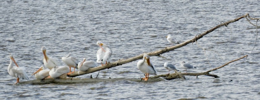
Views of Grand Tower Rock, if you use your imagination, I can see two (possibly 3) muppets with trees for Mohawk hair dos. The current in the Mississippi was so strong. At 1600 RPM we generally go 9.4 MPH. But with this current, same RPM, we averaged 12.1+ MPH. That’s like going 120 miles per hour in car world. Biggest tow yet for us – 5 wide and 6 long, 30 barges!Must be such a challenge to steer around the bends.
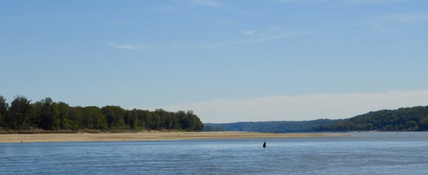
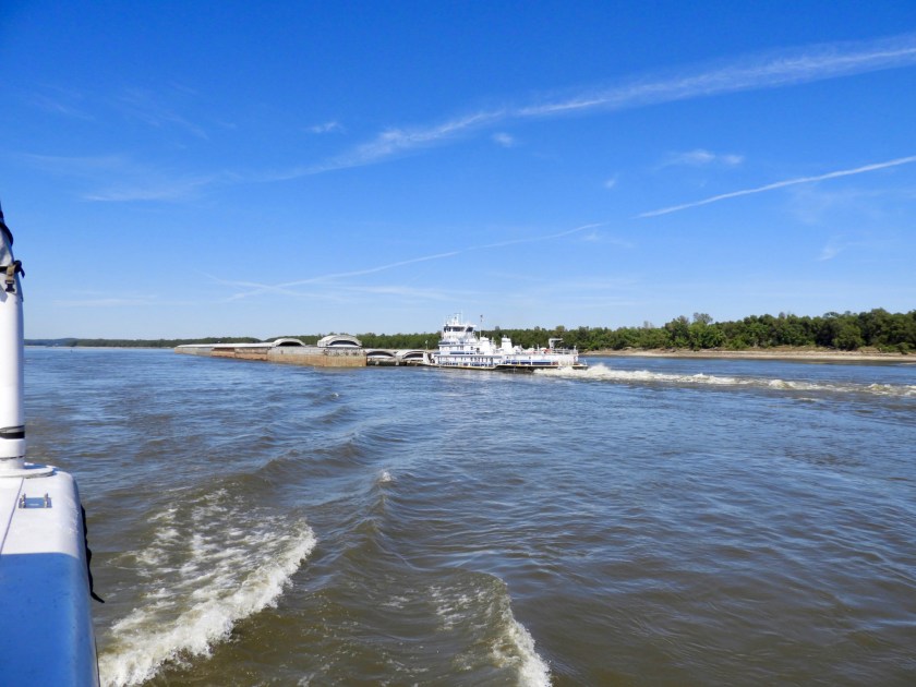
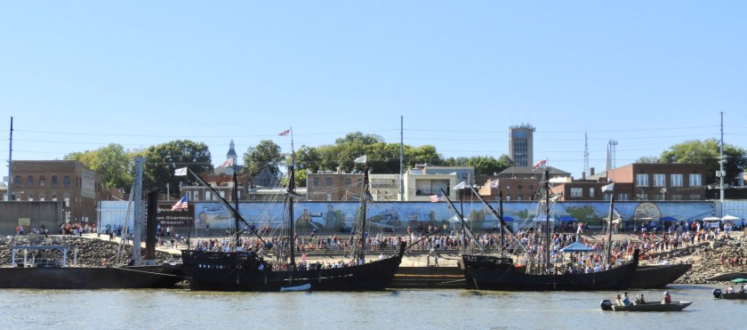
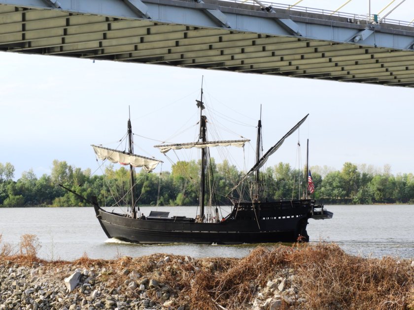
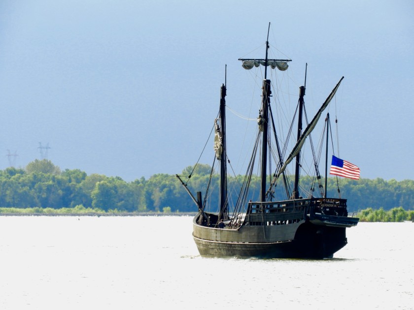
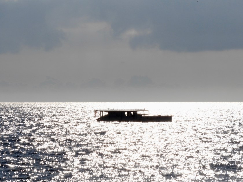
Went by Cape Girardeau where we once again saw the Nina and the Pinta (not sure why there isn’t a replica of the Santa Maria). All these people are in line to view the boats. Guess that’s how they fund their voyage. Cape Girardeau is also known for its murals. So we traveled 120 miles which may be a personal record for us. It was just too fun to keep gliding down the river until we approached sunset. This is our backyard for the night. Looking down (crappy water color) it looks like we are under way, but we’re at anchor. Current is crazy here at 3+ knots. Basically we just pulled over off the channel. Our front yard. Up ahead on the right is a tow that purposely grounded its 15 barges. Not sure what it’s waiting for, but the tow/barges were still there in the morning. So, where are we? About 20 miles south of Cape Girardeau…Or somewhere in the middle of the country.
Bob and I flew home from St. Louis, Mo to Albany, NY on 9/14/17. Our daughter Jess picked us up and we spent a few days in Altamont, NY at our in-law apartment above Jess. So nice to see Jess and Adam and their son Clark. Jess, Clark and I took a quick trip to Maryland, NY to visit my cousin Jeannie. Then we drove to Bowdoin, Maine to visit our daughter Steph, son in law Byron and granddaughters Josie and Sophie. Came back to Altamont and caught up on visits to our friends Margie and Bob along with appointments with MDs and dentists. On 9/22/17 we drove up to Clayton, NY, our home port in tandem with our daughters and families.
So here is the Valkyr, an Erikson 35 purchased in 1968 by Bob’s parents. We basically grew up on this boat. Can’t believe it will be 50 years old next year! How does that happen that 50 years can just blow by? Anyway, Valkyr (now owned by our nephew Clayton) lives in French Bay Marina which is our home port. The wedding of Clayton and Samantha took place at the Antique Boat Museum in Clayton, NY, just across from the marina. We took the Valkyr out for a sail and then after docking her at the museum, raised the code flags for a back drop for their wedding. (the aft flags spell out Just Married, then blah blah blah).Me and grandson Clark. I’m pointing to a freighter and he’s saying “big boat.”Bob at the helm, town of Clayton in the background.Our daughter Steph, granddaughter Sophie, their Portuguese Water Dog Gigi. Missing: Son-in-law Byron (he had to work) and granddaughter Josie (she had to go to school).Our daughter Jess, her husband Adam and their son Clark. Poor Clark, he was swallowed up by his life jacket.Good friends aboard “Little Wing” caught up to us and took this picture. Thanks Jan and Dave!So we clean up pretty well. Our nuclear family, me, Steph, Jess and Bob. Wedding was wonderful!!!
We flew back to St. Louis on 9/26/17. We had a stopover in Washington, DC for about an hour and in that time we met a fellow traveler named David Buxton. He was headed back to his home town outside of St. Louis. He was fascinated with our “loop” adventure so we invited him to visit us on 9/27 at the marina in Alton. Great visit. Hope he can join us some day as we continue the “loop.”
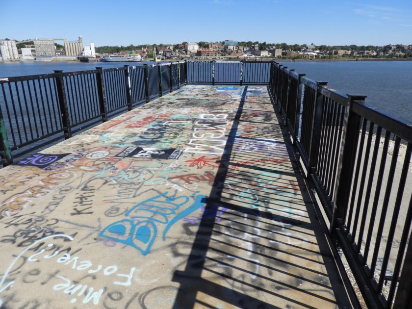
So this was random, when we awoke on Sept 27, we noticed a replica of the Nina passing by!And then the Pinta!So many interesting boats. We rented a car on 9/27 and saw this mural in Alton.Visited a bird sanctuary across the Clark Bridge into Missouri. Here are birds on a wire.And birds in a tiz when Bob whistled at them.Remnants of an old lock, looking at Alton in Illinois from across the Mississippi in Missouri. Gotta love the graffiti.Going back over the Clark Bridge. Love these suspension bridges.Then we visited the Great Rivers Museum near the Melvin Price Lock. Once again, there seems to be a mindfulness of Monarch Butterflies.Inside the museum Bob successfully navigates a 15 barge tow under a bridge near the Arch in St. Louis.Got to tour the Melvin Price Lock just as a 15 barge tow entered the lock! Don’t even know what to say about the color of the water – split pea yuck soup?Looking back, another tow approaches. Our marina is to the right under the second span of the Clark bridge.Bob in conversation with the tour guide for the lock (that we’ll be going through on 9/29).Instead of the gate, a wall comes up to enclose the lock.The tour guide pointed out where a barge hit the wall gate and left two tracks. They have scheduled a repair for January. Glad we will be long gone since that repair will close the lock for a very long time.Next up – a stop at the statue of Alton’s claim to fame. The tallest person to ever have lived, Robert P. Wadlow, was born in Alton. He was 8 feet, 11 inches tall. This is a replica of his actual height. Unfortunately he only lived to be 22 years old (he had a pituitary gland defect causing excessive growth hormone).This is me in the custom made chair for Robert Wadlow.Alton also boasts the restaurant Fast Eddie’s. When the no smoking rules went into effect, Eddie bought the street next to the restaurant and enclosed it so his patrons could still smoke. Not a fan of smoking, but we loved the restaurant. Great food for really cheap prices (i.e. $1.99 hamburgers)Inside the “street”Note the double yellow lines!We placed our order upon entering and scooped up some popcorn and peel and eat shrimp.When Bob went to get the order, I couldn’t help myself, had to rearrange the chairs into rainbow order.One of many cool decorations in the restaurant. Later on the 28th we met with fellow loopers at the marina to plot our strategy for getting through the next two locks. The marina we stayed at was so accommodating – they even provided extra ice at our “docktail” hour in the evening.
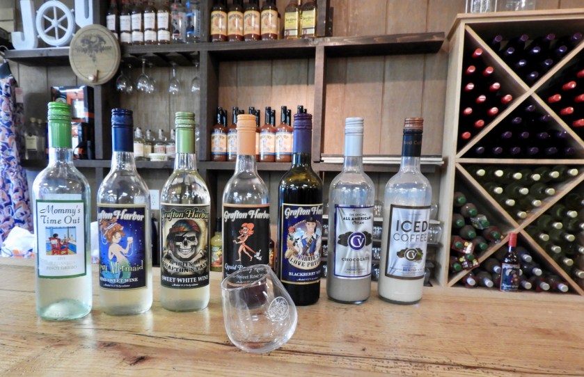
Sept 11: We set out for Grafton, Il which boasts the confluence of the Illinois and Mississippi Rivers. At this point the two rivers are parallel running essentially west to east. The cliffs in the background border the Mississippi River. Most houses close to the river banks are on stilts. The river height can vary 13 feet or more every year. The two Rivers come together. Trivia stuff: By completing the Illinois we have completed the western most part of the Loop. From now on, we edge SSE. Where we are on the map.The Grafton Marina is composed of several floating boat houses. This may be something our home marina may have to consider if the water level remains high. So I went to pay for our slip and got involved in wine tasting. Not your average marina activity! Lots of wineries around here. The most ridiculously named wine was “Liquid Panty Remover.” And the wobbly glass was an odd touch – especially for boaters! We hiked uphill for a half mile to this winery since it boasted “the best view in the midwest.”View of the rivers to the west.Just the Mississippi to the east. And the confluence immediately below us. Sunset lighting back at the marina.
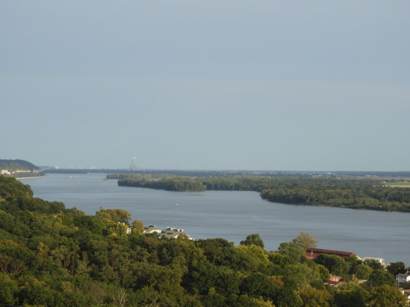
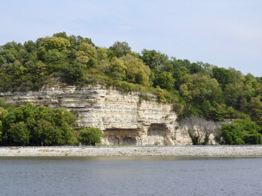
Sept 12: Interesting cliffs along the Mississippi. Another trivia thought – now that we’re doing so many rivers I looked up how many states are named after rivers. Turns out there are 15. If New York was named after a river it would either be the Mohawk or Mahicantuck – the Native American name for the Hudson. It means “river that goes both ways.” Nice statue.Casino (and old factory) at Alton, our next port of call. Islandia’s home for two weeks while we fly home on the 14th for Clayton and Sam’s wedding (and to visit the kids/grandkids!). The Alton Marina also has floating boat houses with many personalized “patios” if you will. Floating pool, hot tubs, shower house, marina office, laundry and small restaurant. Looper rate: 65 cents a foot! Not bad, compared to Chicago which was $2.55 a foot. One span of the New Clark Bridge is in the background. Good night Mississippi – see you in two weeks!
Sept 8: Going by the waterfront of Peoria, Illinois. Only one lock to go through today. After a summer of record high river and lake water levels, we are now encountering low water. The red nun buoy is on the shore. We’ve seen several buoys aground. Wonderful to see so many bald eagles.And immature bald eagles. Over the course of the next two days we saw dozens of eagles. To get to our next port of call the Guidebook said to turn left at the sunken barge.Our marina and anchoring choices for the next hundred miles or so were very limited. Most of the anchorages and the only marina with amenities were not an option due to the extreme low water. But the bartender at the Pekin Boat Club said we could tie up on their gas dock (all other docks were on land). Beggars can’t be choosers! 78 feet of boat on a 50 foot dock. (Photo credit: Brian Werder on Vahevala). The Pekin Boat Club bar and restaurant is to the right. You can see how low our boat is in comparison to the deck of the bar. In the spring when the Illinois River flooded, the bar tender told us boats were able to dock at the deck! A few hours after taking this picture the parking lot filled up with local patrons for the Friday night drawing of a private lottery. The winner automatically gets $100.00 but then has to pick a winning box among 40 boxes to claim the grand prize of $45,000.00! The winner Kim didn’t select the correct box so the pot gets to grow for yet another week. BTW, can’t beat the prices – no docking fees, beers were $1.50 and the Taco dinner was $5.00. Least amount of fees for dinner and docking to date. Sept. 9: No locks today – just a view of a former lock. Traveled 60+ miles to the next non-marina tie up.
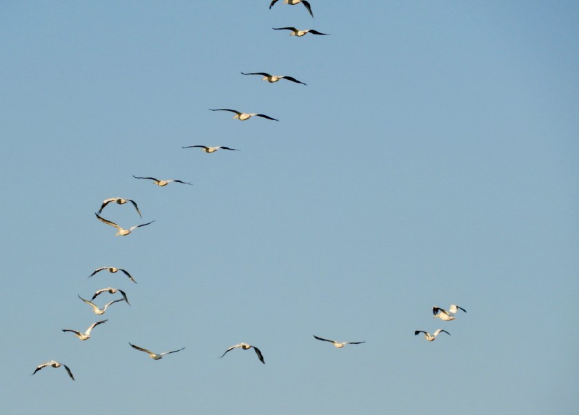
Couldn’t get over the number of pelicans we saw today – all in the sky, none on the water. The white splotches behind the tug boat are Asian Carp jumping out of the water. I inadvertently got a picture of a monarch butterfly (lower right hand corner). Some of the carp actually landed on the boat’s stern deck. Don’t know if they’re good eating, but my guess is they’re not. Coming around a bend we came face to face with this 15 barge tow. No problem. With our AIS we know they’re coming so we simply call on the radio for instructions. A one whistle pass is port to port, and a two whistle pass is starboard to starboard. Scooting along the Illinois River – picture by Linda Werder on Vahevala. So the next “marina” was the Logsdon Tug Service. No amenities to speak of, they simply let you tie up to their barges for a dollar a foot. You’re on the honor system to place the money in a locked box. Creepy stairwell.We were second in line. More boats joined us (photo credit: Brian Werder).I went out on the paddle board to take this panoramic photo. First time I’ve been on the paddle board since the end of July. Where did the summer go?Sunset cruise on the paddle board (photo credit: Bob). Sept. 10: Eight of us Loopers left before sunrise to get to the next lock. We’ve been concerned about this particular lock (LaGrange Lock and Dam) for over 2 months. It has only been open at night and on Sundays due to extensive work being done on the lock. Going through at night is not really an option for pleasure boaters because the nearest place to tie up is 60 miles away downstream. We planned our arrival for Sunday and went as a pack (safety in numbers!). Thought we were seeing geese over head…but no, more pelicans!Didn’t know they traveled in formation. Got to LaGrange Lock around 7. Had to mill around for awhile. The lock master let us in after this tow came out. Lucky us!!! Some tows, like this one tied up to nearby trees, have been waiting for hours if not days to get through. Another 15 barge tow coming around the bend after we tied up for the night. Tonight’s barge tie up was at Mel’s Illinois Riverdock Restaurant. Great food – and no docking fee if you ate at the restaurant. So we are now about 40 miles north of St. Louis. Looking at the weather map we see Irma could be coming our way – but of course – not as a hurricane. Fingers crossed that all the homes of all the people in Florida get through the night with as little damage as possible.
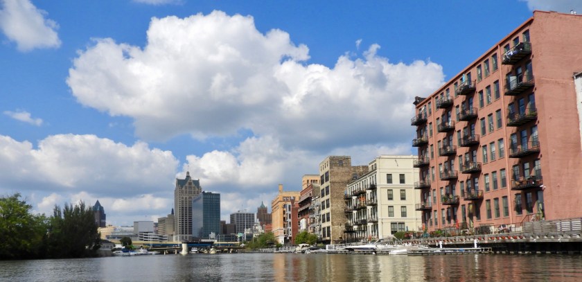
Sept 5: We left Chicago and traveled 11 more miles south to enter the River System through the Calumet River (again, we were too tall to go through Chicago). The water just before the breakwater represents the last little bit of Lake Michigan. For the next 1300 miles we will be on a series of rivers, eventually coming out in Mobile, Alabama. Lost track of the number of bridges we went under. Just beyond where this freighter is docked is a large turning basin for it to turn around in. Oops! This boat has seen better days….Out of the Calumet River and into the Illinois River. The Red Danger sign warns boaters of the electric barrier that goes on for half a mile. The DEC is really trying to prevent Asian Carp from entering Lake Michigan. No swimming here! Afterwards we saw tons of Asian Carp leaping out of the water. Very industrial. Traveled about 60 miles in total to Joliet, Il where they have a free wall (with free electricity) for boaters. We were able to squeeze in with a shoe horn. There were 16 Loopers – a record for this wall. Great “docktails” that evening! Sept 6: Left early to go on to Ottawa, Il. Scenery was much more rural. Nice to see so many white egrets. Our mini parade of boats went outside of the channel to avoid this tow. (Per guidebook, the tow boats pushing barges are called tows, even though they are actually pushing the barges, oh well!). Stayed at a nice marina in Ottawa (Heritage Marina – half price night – nice!). Got up early on Sept 7 and the full moon was still shining. Morning light on the transom of the boat in front of us, with the full moon still out. Loved the lighting. A nice change of scenery – bluffs!Rafting up in one of the three large locks we traveled through today. Going by Starved Rock State Park – I need to find out about the unusual name. This part of the Illinois River reminded me of the Erie Canal. After months of high water it’s weird to see low water – note the red buoy off to the left on the sand bank! The water is three feet below the norm – go figure!I thought the white birds in the distance were simply seagulls….Nope – pelicans!!! Not expecting to see pelicans. Perhaps they got the word about Irma and evacuated to Illinois.Lots of snow geese too. A real paddle wheeler!Two of the boats from our group split off to anchor out for the night. Unfortunately this boat ran aground (again, water is unusually low). We threw them a line.Took a bit of doing but we got them off the shoal. This tow was so large – couldn’t get it all in the frame…Twelve barges!So a group of pelicans is a “ballet” which is exactly what these pelicans look like they’re doing. And off they go. Preening and primping time. Happy hour at the Illinois Valley Yacht Club just outside of Peoria, Il. Looking southeastand northeast. Nice Yacht Club, established in 1907 and has a Laser Fleet. Moonrise on Sept. 7.
We left Waukegan early Sept 3 and had an easy run down to Chicago (about 30 miles). Here we are going by Northwestern University.
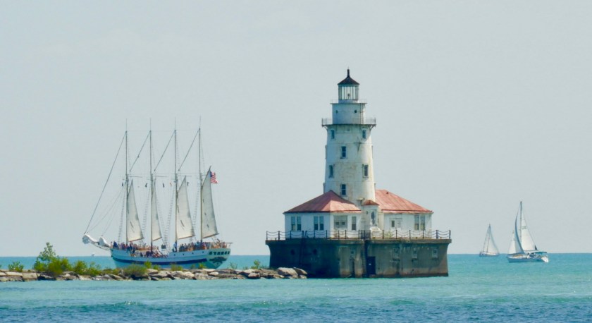
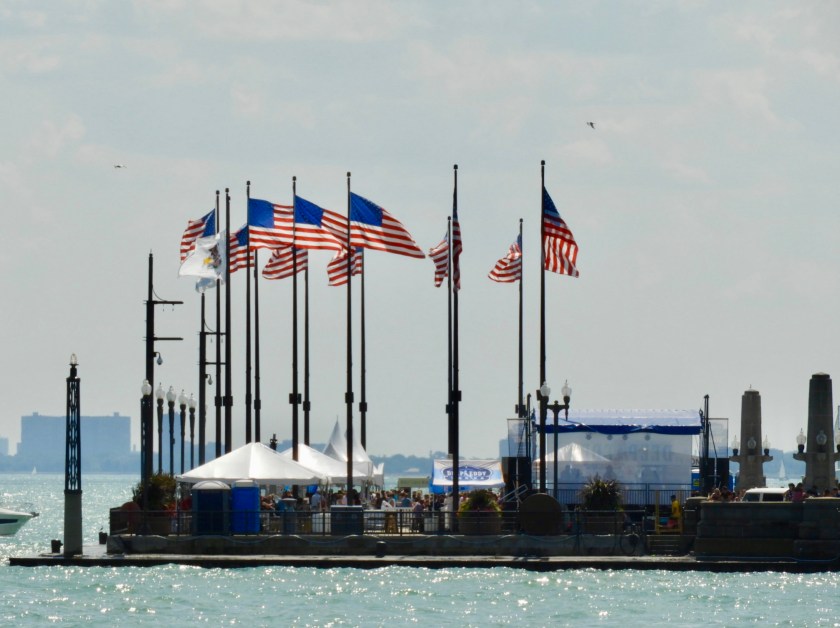
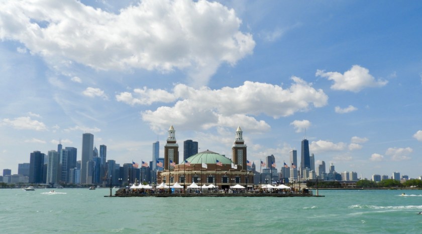
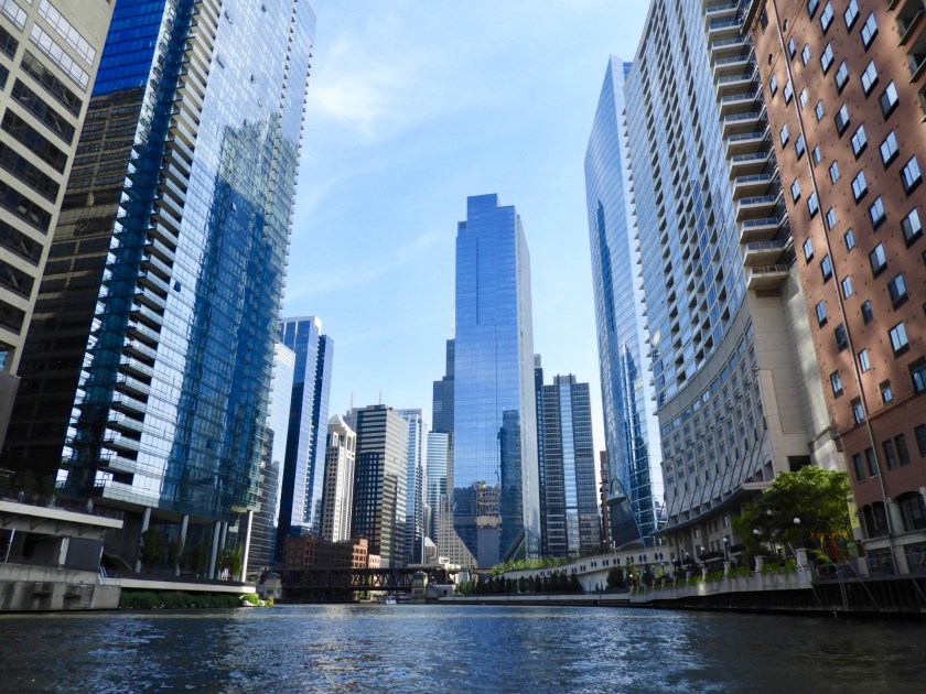
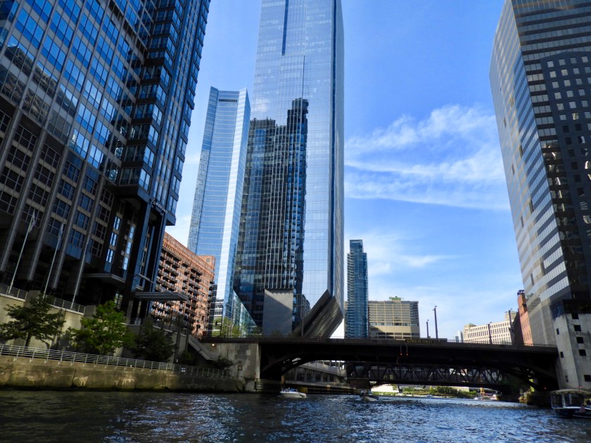
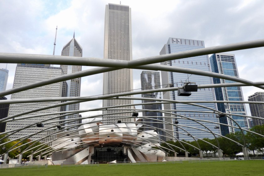
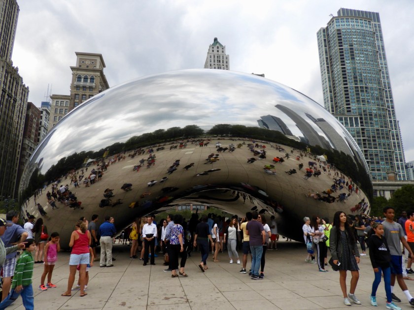
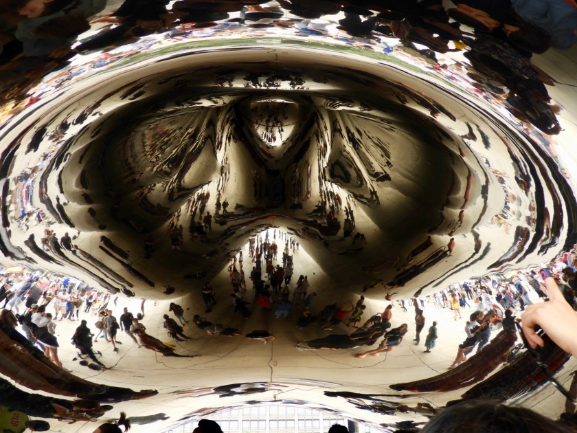
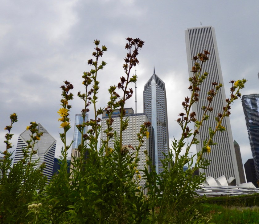
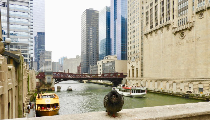
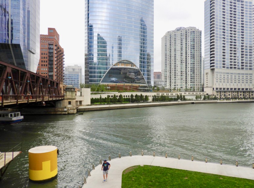
Sailing class for some very young sailors!Chicago comes into view.Love the skyline.Tall ship on the outside of the breakwater.And later, all sails flying. Windy day as we approach the Windy City. Going by Navy Pier.Being the height of Labor Day weekend, there were zillions of pleasure boats about and boatloads of people on them. DuSable Marina – huge!A very cool racing “sled” ahead of us in the marina.The Ferris Wheel is our front yard today. Since our “air draft” of 19 feet was too high to go under the many bridges of Chicago, we took our dinghy in to see all the buildings. The entry to the first lock was a madhouse. But we got through, no problem. A popular spot to dock and dine.Wedding party posing on a bridge.Further into the steel canyon. Great reflections.Tenting along the river? We heard that there is an organization that gives tents to the homeless. No sure if this is true or not, but we did see quite a few tents (along with BBQ grills as well). I don’t know why this building doesn’t just topple over – looks like an architectural marvel to me. Clark Street! And in the background is a cool apartment building with 7 bottom floors for parking. Don’t back up too far!Another popular watering hole. Headed back to the marina we noticed a sister ship to my sister’s ship – loved the flags too. The ferris wheel at night provided a nice light show, almost like watching fireworks. Labor Day, Sept 4 (Happy Birthday cousin Anne). Took a walking tour. Here we are passing by The Jay Pritzker outdoor concert pavilion.The popular Cloud Gate also known as The Bean. The ultimate selfie spot.Trying to find ourselves in the kaleidoscope of the Bean. There we are!Crown Fountain – lots of fun for everyone. Looking up at the buildings through one of the gardens nearby in Millennium Park. The left most building was featured in the end of the movie “Adventures in Babysitting.” Old against new.
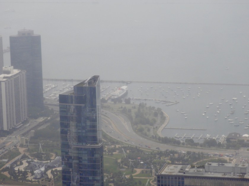
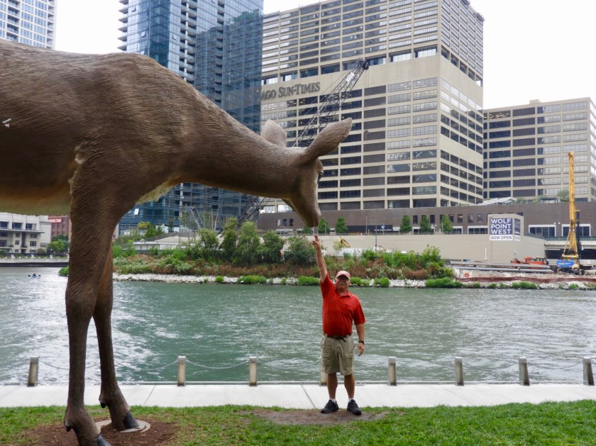
Smiling – then stoic – then charismatic street performer. Lions outside the Art Museum.Ironic ad for Pure Michigan on Michigan AvenueWe stumbled upon the very beginning of Route 66.Looking up at the very tall Willis Tower – once the tallest building in the world. Waited in line, paid a lot of money and then got to the top of the tower. Looking down at our marina. Bum luck – two minutes after I took this picture a rain squall hit. We had a view for about 5 minutes and then we were completely fogged in!Back to the bottom, the top of the building is still in the clouds!Bird’s eye view. Reflection on the building acts as a mirror for on coming boat traffic. Back in the 1930s this was the world’s largest building, the Mercantile Mart. Owned several years by the Kennedy family. Bob got a chance to feed some of the local wildlife. A colorful couple.Chicago’s Vietnam Memorial.
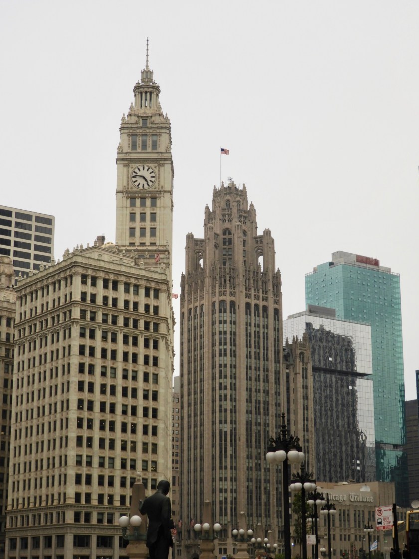
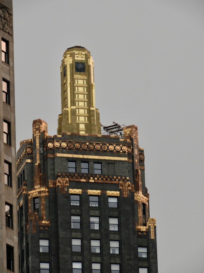
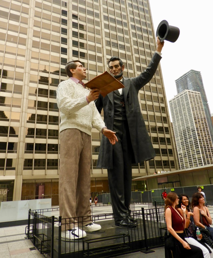
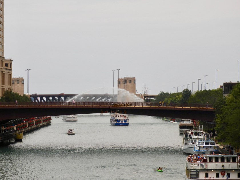
The tops of the buildings, especially the older ones, were so unique and intricate. And hey, it’s 5:00 somewhere!Giant statue of Abraham Lincoln and Joe Q. Public.Not sure why there was a water salute for this tour boat. Back at the marina we have a new neighbor – complete with a motor cycle on the bow. Bob was jealous. Of course, leaving Chicago, the sky couldn’t have been bluer. Oh well, we’ll do another tower visit another day.
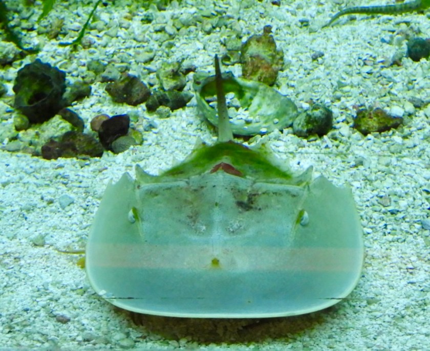
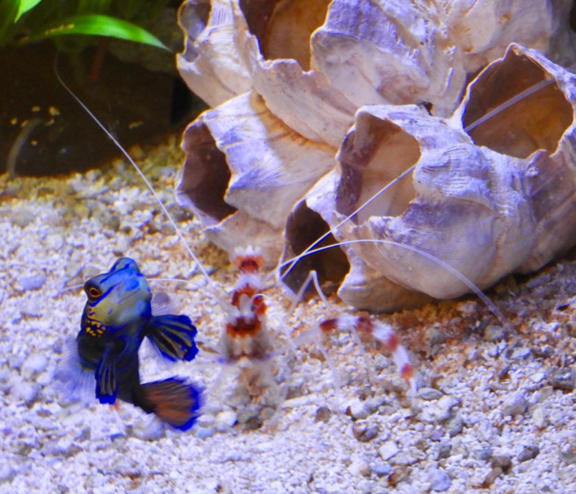
August 31, 2017: Beautiful but blustery day, looking out over the breakwater near the marina in Milwaukee.Lighthouse at the middle entry to Milwaukee. We didn’t mind the wind today since we planned to stay in Milwaukee for another two days.Along the walking path from the marina to downtown Milwaukee we found MacArthur Park (but no cake left out in the rain). The main Art Museum is a work of art in itself. Here the movable wings are spread out.Later the wings were closed (they close if the winds exceed 23 mph). We spent about 4 hours in Discovery World. A terrific science/technology museum that had numerous hands on exhibits for adults and kids. There was also a really interesting section on Les Paul’s work with sound mixing and recording. I’m a sucker for aquariums – these next few pictures are for my grandkids. Horseshoe crabAlways fun to watch seahorses.Finding NemoCleaner shrimpMandarin fish (on my bucket list to see on some future diving trip). Back out on our walking tour, had our picture taken with the Bronze Fonz. Per guidebook this is the most popular selfie spot in Milwaukee. One of many cool buildings. The top of this building made me think of the Dan Brown novels – perhaps a clue in either The DiVinci Code or Demons and Angels?Had a great reunion with school friend Deb Anken and her husband Chuck. (Deb and Bob’s brother Ray went to Kindergarten together and we were all great friends in High School). Deb and Chuck drove from Madison (75 miles away) to meet up with us. Went out to dinner and had lots of laughs. So great to see them!!! September 1: A typical challenge at marinas is to try to hook up to the marina’s wifi. Usually the signal is too weak to be useful. Well, problem solved at this marina. Here we are 2 inches away from a repeater!! Greatest signal to date! Later on we met up with our sailing buddies Terri and Hal aboard C’est le Bon. Haven’t seen them since July 31. Had a great reunion with them as well. Sadly they flew home the next day to check on their house in Houston (not flooded as far as they know) and to help out Hal’s brother rebuild his badly flooded home. Sept. 2: Left Milwaukee early. Skies were blue but the seas were rather lumpy from the recent winds. Felt like being a cork in a washing machine. This lighthouse near the border of Wisconsin and Illinois had quite the original name: Windy Point (!!). Our destination was 50 miles away in Waukegan, Illinois. Happy to be at a dock after all that wave motion. This garden near the marina office sported cherry tomatoes and kale mixed in with the flowers. The highlight of getting to Waukegan was meeting up with my friend (and former patient) Clara (and her lovely dog Bella). Clara was one of my most inspirational patients with an amazing attitude for overcoming quite an adversity (full tongue removal secondary to cancer). Her ability to regain speaking and eating skills was an incredible achievement. I’d like to say I was helpful to her, but in reality it was all her – determination, positive thinking and creativity.
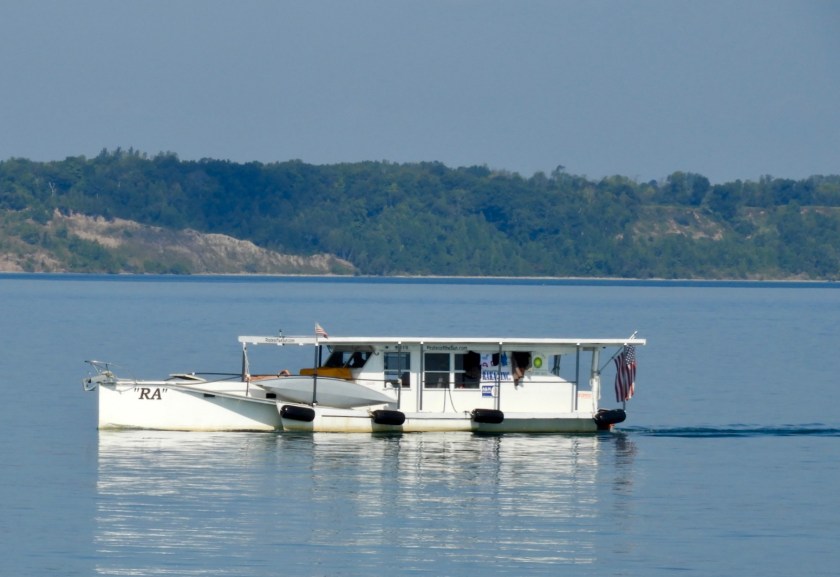
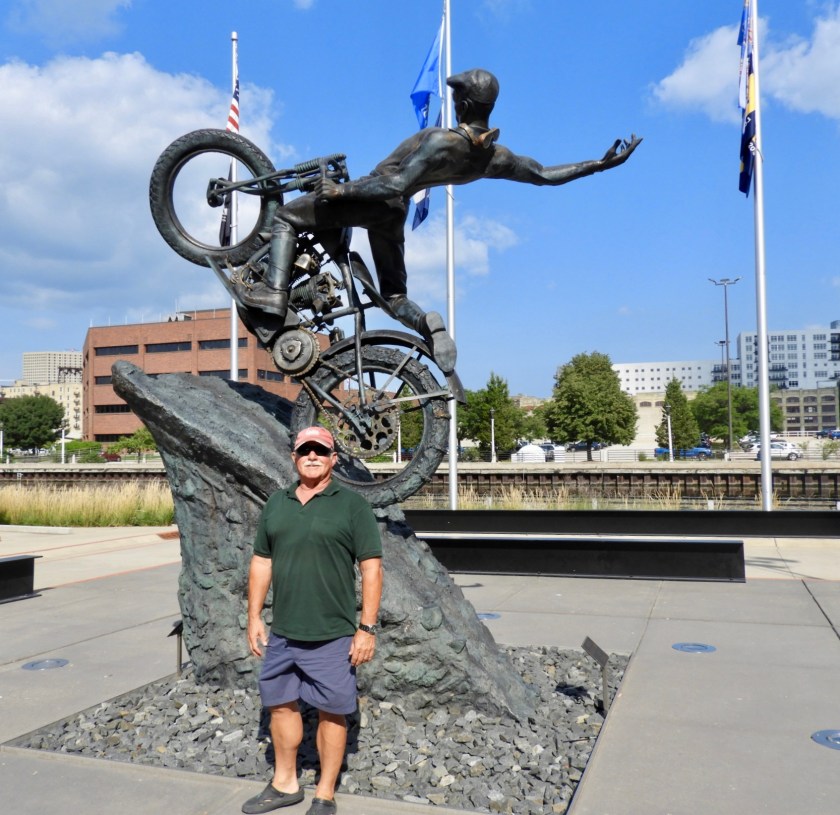
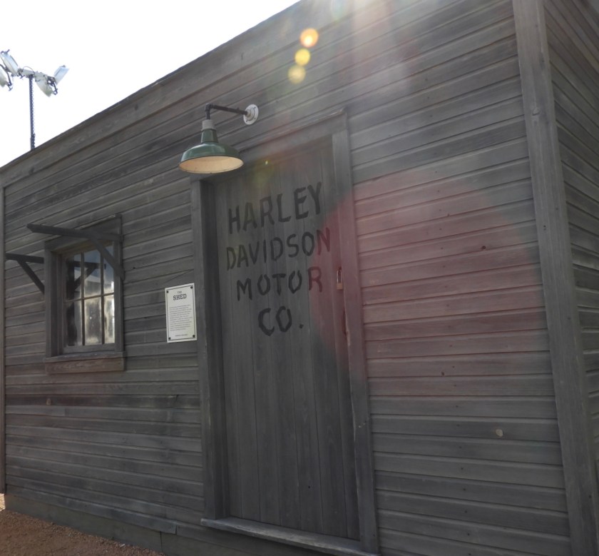
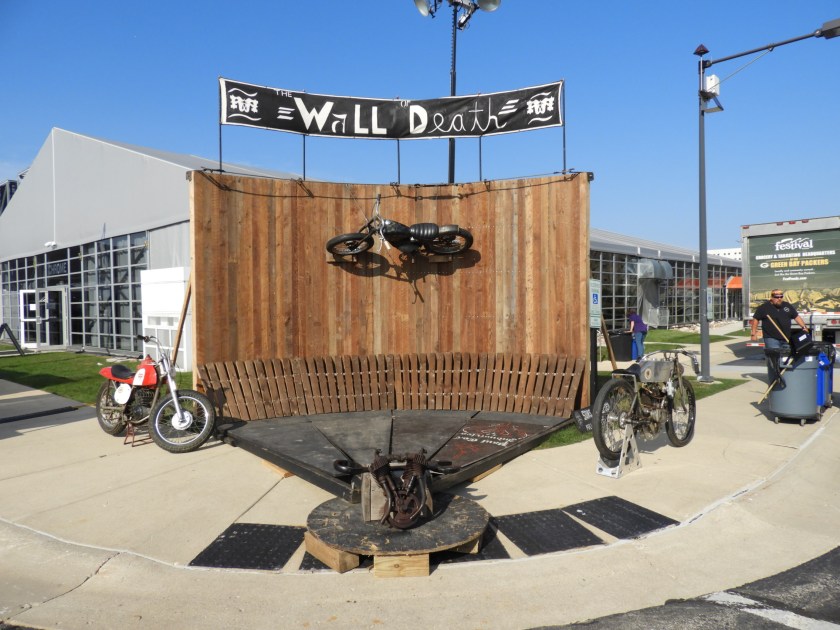
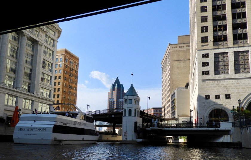
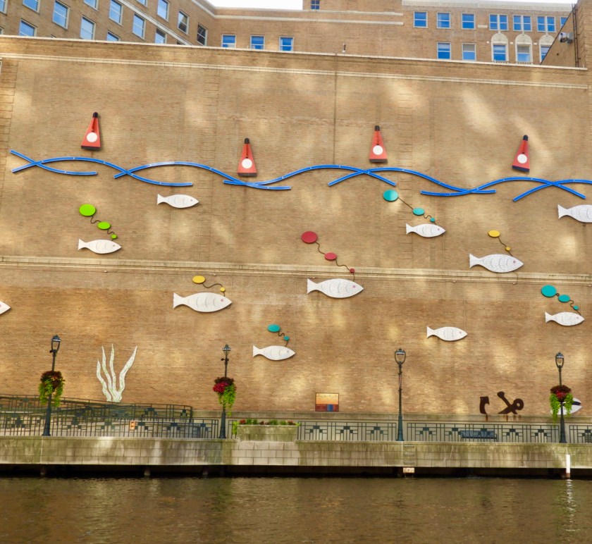
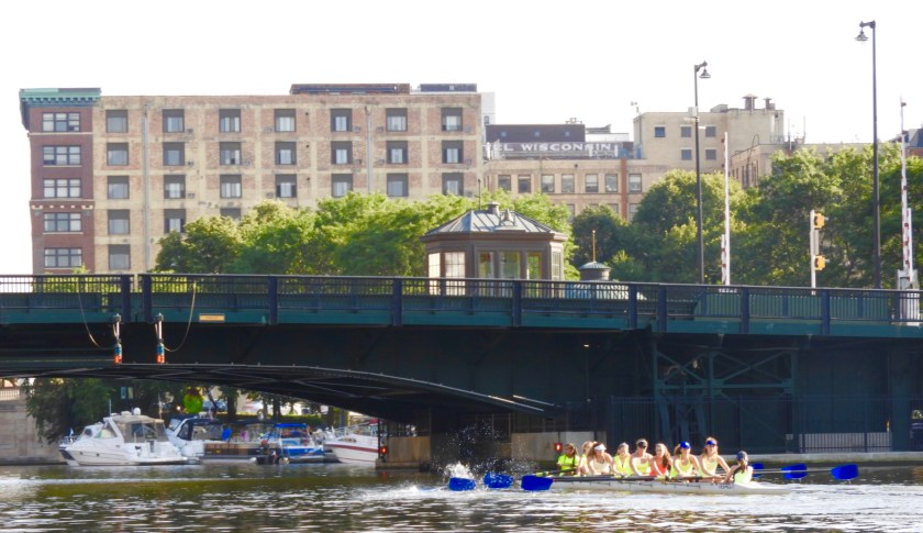
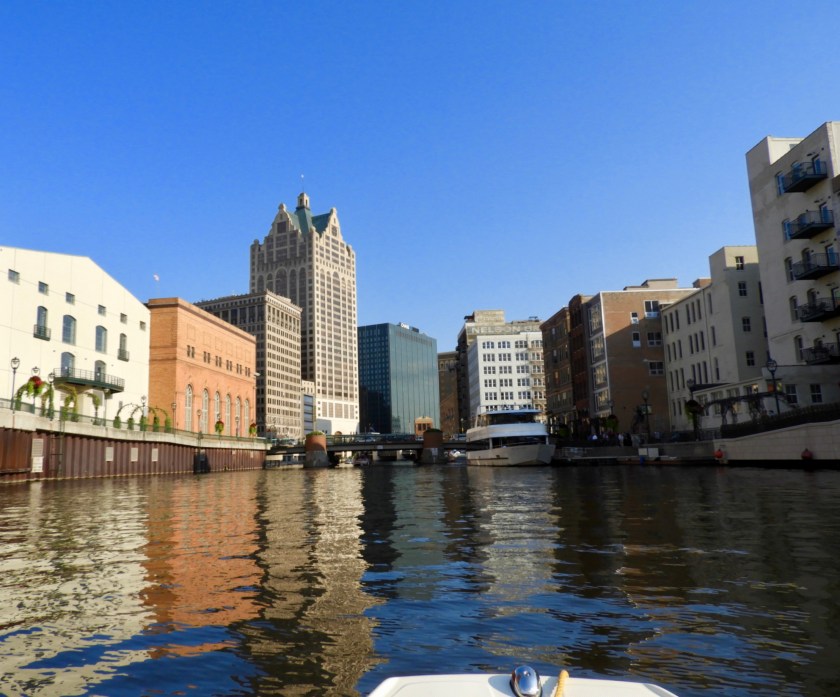
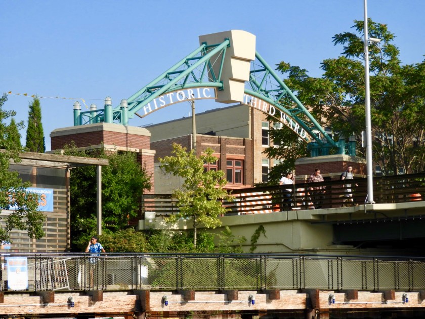
Perfect motoring day which the RA really appreciated. They actually zipped along at 5 knots. Their goal was to get to Racine, about 50 miles away. Over 20 navigational controls and devices – Bob believes in redundancy! We’ve come a long way from a compass and a watch on Valkyr as kids. Easy cruising today with flat seas, no wind and Otto (the auto-helm). Headed in to the massive McKinley Marina in MilwaukeeThe Denis Sullivan is a replica of a 19th century Great Lakes Schooner, which of course takes tourists out on a daily basis in the summer. Art Museum is to the left. This is an Erickson 39 – sister ship of the “Chiquita” a boat Bob and mainly his brother Ray used to race on Lake Ontario. Brought back fond memories for Bob. Took our dinghy into the confluence of the rivers going through Milwaukee.Lots of condos that looked like converted ware houses. Nice use of old buildings. Oh hooray- the Harley Davidson Museum!The Museum had a dock for tying up so we were able to look around.Milwaukee’s finest posing with a tourist. Replica of the original shed where the company was born. Can’t make this up, Rhett Rotten and his sidekick put on a dare devil show. This is Rhett. What’s hard to appreciate is that the motorcycle is actually running at a high speed on rollers. Then the show went inside to see Rhett climb the Wall of Death. Crazy!Wall of Death Diorama. Leaving the docking area for further exploration of Milwaukee (neither of us have ever been to Milwaukee).An old facade. Went under a closed railroad bridge – must be a tradition to leave a bottle or can if you pass under it. There was a series of about 10 lift bridges for the tour boats to go under. Fun 3-D Mural.One of 4 girl’s rowing teams…and one of the boy’s rowing teams. Went by Schlitz Park and Brewery. Also noted the clever wall mural to disguise the water outlets. It was very cool to be in the middle of a big city. We’ll have to look up what the Historic Third Ward is all about. Headed back to our marina. About an hour later the weather completely changed from sunny and beautiful to nasty rain, thunder and lightning. Once again, looks like we’ll be weathered in for a few days.
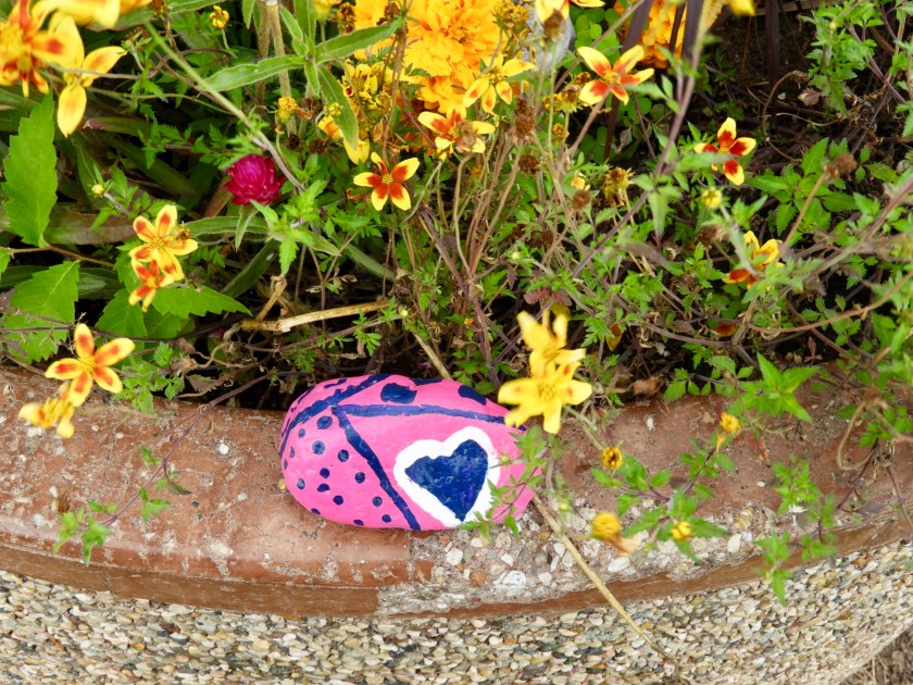
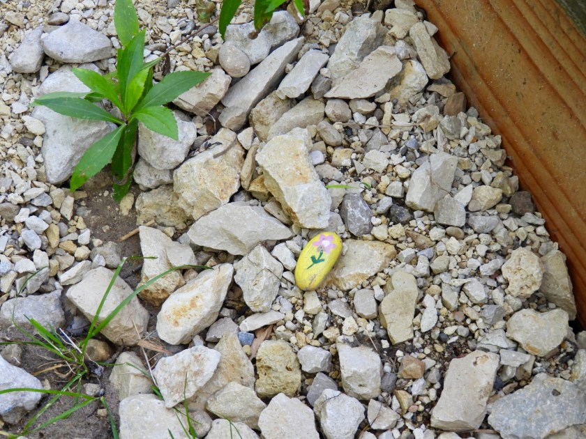
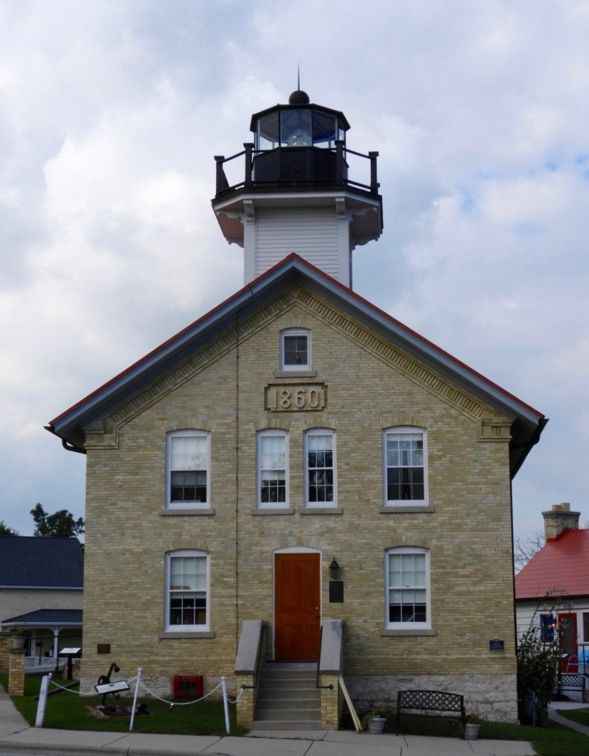
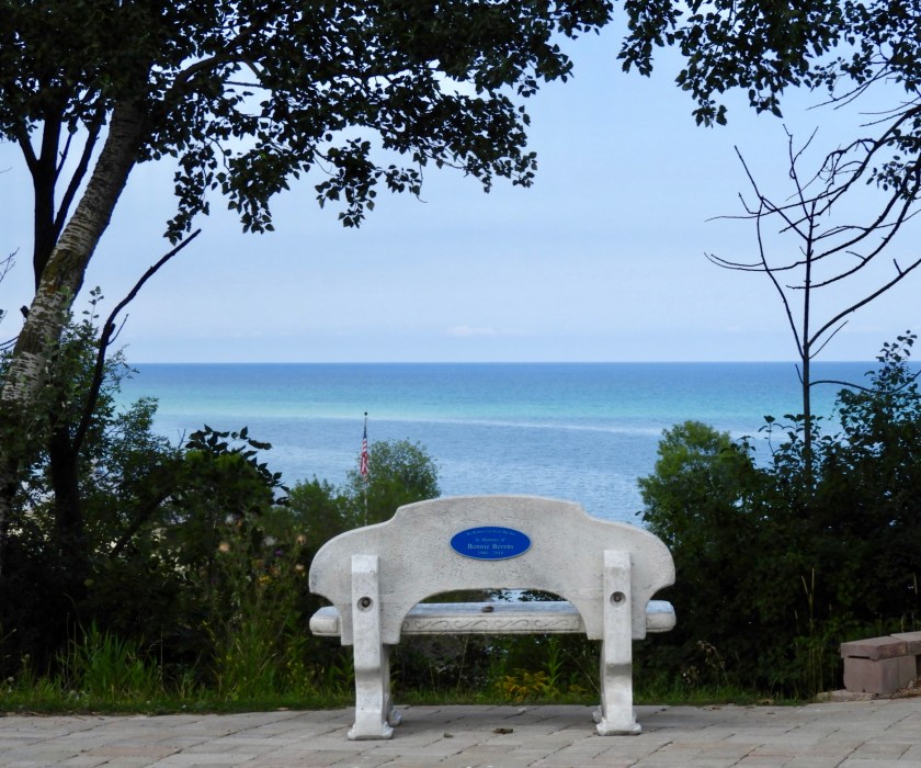
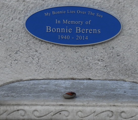
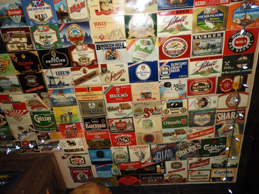
August 27: We re-connected with some sailing folks we met in Pentwater, MI, Denise and Ken Cornell. They said to look them up if we crossed over to Sheboygan, WI. So we did. Turns out Denise is Commodore of the Sheboygan Yacht Club. They took us to a grocery store to reprovision and then we had a great time visiting them while eating at the Sheboygan Yacht Club. August 28: Our 41st anniversary – haven’t killed each other yet! Took the dinghy up the Sheboygan River (which is actually 81 miles long!). Loved the majestic willow trees. End of the line for us, after this turn there was a series of dams. Coming back down we noticed this structure, thought it was an outhouse, but upon closer inspection, we think it was a fish cleaning station. We had lunch at a local eatery on the boardwalk and then I hopped off the dinghy to further explore the area. This is the entry to the Blue Harbor Resort Hotel. So, if I were queen and sitting in that throne of a chair, I would change the color of the roofs to blue. Lake side view of the Blue Harbor Hotel. Cool pathway to the dunes. Leading to this lovely view of Lake Michigan. Flowers everywhere – I noticed this painted stone in the flower pot. Flipped it over – “Sheboygan Rocks” Turns out this is a continuing theme here. There’s a facebook page titled Sheboygan Rocks. People here just delight in painting rocks and hiding them for people to find. Similar to the Petoskey Rock thing we discovered a few weeks ago. Yet another one. After I took this picture of the painted rock in the lower right hand quarter, I then noticed the monarch butterfly in the upper left hand quarter. Sunset spinnaker run into the harbor. Seas are finally calming down. Looks good for us to leave tomorrow morning. August 29: Left Sheboygan at 7:15. Nice view of the Blue Harbor Resort. We passed the RA around 9am. Here it is soaking up the sun power. Entering Port Washington, WI. Half industrial, half cute little town. Winds were minimal but the seas were all mixed up from two days of 20+knots of wind. Felt like we were in a washing machine. Happy to be in port after a four hour run. Seems so calm looking north. Took a walkabout through town. Liked this monument. Looking north from a bluff. And then south. My walk took me through a neighborhood. Interesting house statues to say the least! Then I walked back into town via the Ozaukee County InterUrban Trail – complete with a community garden. Captured this goldfinch in some thistle. Another goldfinch landed on this thistle, but of course took off as soon as I opened up the camera. Along the trail was a creek. Noticed this painted stone and on the underside “Oz Rocks” was written. Turns out Port Washington which is in Ozaukee County has their own version of painted rocks and posts them on the Facebook Page of “Oz Rocks.” Back in town, these steps lead up to a Light House Station. Wow! 108 steps! Guess I got my exercise for the day! Lighthouse at the end of the tunnel. The grounds around the lighthouse. Unfortunately, the lighthouse is only opened for tourists on weekends. This anchor belonged to the Northener – which was built in Clayton, NY in 1850. Didn’t appreciate that boats of this size were built in our homeport. Guess I’ll have to recheck the Antique Boat Museum next time we’re in Clayton (which will be September 23 for Clayton and Sam’s Wedding!). Looking out from the Lighthouse to the Lake. Detail from the back of the chair. And bonus – yet another Oz rock!Back down and headed to our marina I noticed the RA was docked. Yay! I was a bit worried about them. The seas were nasty and they can only travel 3 knots (3.5 miles an hour). Talked to Captain Jim and he was pleased to get this far. He’s headed to Racine tomorrow, but Milwaukee is his backup plan. Bob and I went back into town and he noticed this Cadillac. No where near his grandfather’s Cadillac, but perhaps a future car for Bob? He loves a hatch back!Went to Sir James Pub which has so many beers they have a binder listing them alphabetically. They boast over 900 beers and 150 whiskeys. Ceiling detail – all the blocks of ceiling tile have been covered with the various beer carton covers. Bob decided to have a Weihenstephaner with Sir James. The beer is from the oldest brewery on the planet – around 1100 AD in Bavaria.